NCTIR: Rebuilding a Network Where Mountains Meet the Sea

TWO minutes after midnight on the 14th November 2016, New Zealand was violently rocked awake by a massive 7.8 magnitude earthquake. New Zealand’s South Island was plunged into darkness, as power failed, buildings collapsed, and a state of emergency was declared.
After the sun finally rose over the South Island, ending the terrifying, sleepless night, the devastating scale of the damage became clear…
“It looked like a dinosaur had walked through the corridor and just smashed its tail everywhere” – Mike Seabourne, NCTIR Communications Manger
The Quake That Disrupted the Nation
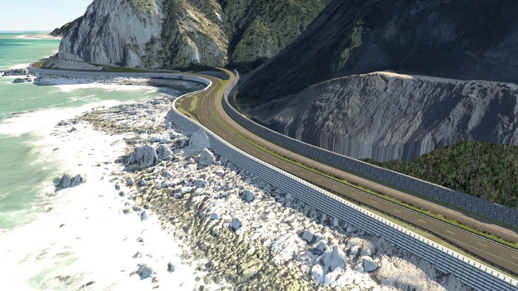
The earthquake caused substantial damage to the transport corridor from Picton to Christchurch via Kaikoura. Both State Highway 1 (SH1) and the Main North Rail Line were closed. Huge fissures were scored into the earth, mountains were crumbled. SH1 was covered in landslide debris and thrown into the sea. Railway lines were lifted into the air and strew across the landscape. Communities became isolated and industries were thrown into limbo.

NCTIR Was Born
The North Canterbury Transport Infrastructure Recovery alliance (NCTIR) was born out of this devastation, with the vision of reconnecting the isolated communities by – literally – moving mountains.
Watch a recording of a fantastic presentation given by Charlie Dickson (NCTIR Civil Engineer [Christchurch City Council]), Stuart Hamilton (NCTIR Roading Design Lead [Aurecon]) and Cameron Paintin (NCTIR 12d System Administrator [Riley Consultants]) at our 2018 12d Technical Forum.
Learn how 12d Model and 12d Synergy was innovatively used to successfully rebuild the road and rail network where mountains meet the sea in only one year, one month and one day.
Some of the Challenges Discussed in the Presentation Include:
1. Realignment of survey network
2. Gaining accessibility to the sites
3. Ongoing risk of rockfall
4. How to capture the terrain
5. How to manage and distribute the mountains of data collected
The Earthquake That Broke The Rules
The Kaikoura quake broke the rules of numerous long-established and accepted theories, being described as the most complex earthquake ever studied. Ruptures occurred on multiple faults across a 200km strip of land. Parts of the South Island were pushed 5m closer to the North Island. Chunks of ground buckled and were flung upwards, to a height of 8m in some places. The tectonic event moved the land up to 12m in all different directions in 74 seconds – a nightmare for surveyors and civil designers!
• 5m vertical displacement
• 21 faults. 5000 land-slides
• 1,000,000m³ of rock and debris to move
• 190km of road and rail damaged
• 69 road bridges, 20 rail tunnels and 59 rail bridges destroyed or damaged
And all of this was to be solved in only one year, one month and one day.
NCTIR worked 24/7 to meet the ambitious reconnection targets. The scale of the project is jaw-dropping. At its peak, the road and rail repairs were using up all of the concrete available in New Zealand.
Learn how the massive $2B project innovatively used 12d Model and 12d Synergy to rebuild a network in a narrow corridor where the mountains meet the sea, in an unprecedentedly short amount of time.
This is one Innovation Showcase you definitely need to see!

Author