Whether you are designing, drafting or surveying you are placing your mark on a specific location on Earth. You work in the real world and much of your data has an exact spatial location. Being able to easily search and visualise this location makes finding, interpreting and working on your data and jobs easier.
How a Search Can Save You Thousands
Picture this: you have been put in charge of the business’ new project, redesigning a major highway intersection. You swear that the intersection has already been surveyed. You don’t know when, you don’t know who, but you swear you’ve got the data. But god knows where it could be…
You search, all-day all-night. You trudge bent-double through dust-covered hard drives and long-forgotten local and network drives. Reluctantly you involve IT… time ticks, hours turn to days… but they just shake their head.
%$@# where’s the data?!?
You’re left tossing and turning all-night. Should I? Or should I not? You’ve had enough. You bite the bullet. You give up on the search and re-commission the survey anyway. All of it, all over again. Thousands of dollars are burnt.
12d Synergy 4: Spatial Search
Spatial search provides you with a high-level geographical overview of all your data and jobs, enabling instant visibility over all your existing data assets. 12d Synergy automatically geocodes Australian and New Zealand addresses with latitudinal and longitudinal coordinates. Your maps are automatically updated as your job progresses.
Watch: 12d Synergy Spatial Search Overview
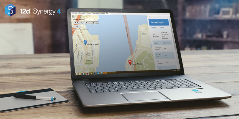
Search results can be viewed either traditionally as a text list or visualised on a map with data locations shown as marker pins. This makes using spatial search very quick to learn and easy to use, and more importantly fast.
Spatial searches with 12d Synergy can be performed in three ways:
1. Search by a specific address attribute: For example, “show me all jobs within 2km of here” or “show me all reports near here with the name XXXX”.
2. Search by marker: drop a pin on a chosen area and search with a radius of your choice. For instance, “search for all jobs within 5km of Brisbane CBD”.
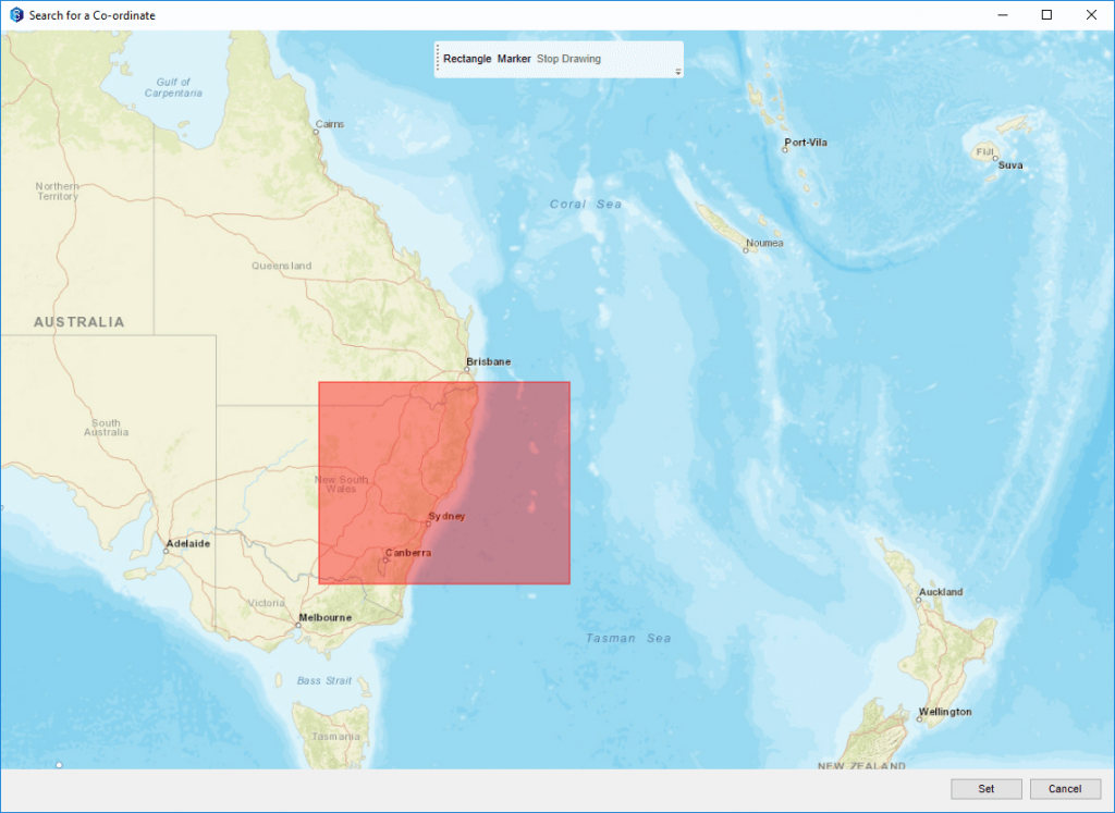
3. Search by region: simply draw a rectangle on the map to select the region you want to search.

The Benefits of Searching Spatially
Have you ever had to recommission a survey – or a similar job – simply because you didn’t know it had already been done? Have you been unable to find where previous survey data has been stored? Have you commissioned a survey, only to find out weeks later that there was a conflict of interest and you had to completely scrap the project?
A single spatial search in 12d Synergy can solve all of these dilemmas, saving you thousands in unnecessary recommissions, project reworks and time wasted searching for data.
12d Synergy’s spatial data lets you quickly and easily answer:
• Does our business have previously recorded data that could be useful?
• Is there a conflict of interest in this location?
• How are my job’s related?
• Has there been a previous job here?
Identify Conflicts of Interest Early
12d Synergy’s Spatial Search provides you in seconds insights into potential conflicts of interests before you begin work. This can save you thousands in unnecessary survey work or data purchases. The surveyor is also saved the frustration of having to redo a survey simply because the data has been lost.
Know for Certain What Data Assets You Already Have
Spatial Search also identifies any existing data sets which could be of use for your current projects. A single search quickly answers whether or not you already have data assets for the site, or nearby.
Single Source of Truth
12d Synergy brings all your data, which may currently be scattered across different systems and random hard drives into a central location. This makes accessing and working off your data much easier and faster, eliminating hours of time wasted searching for lost data.
Fast Searching
Spatial Search is FAST, by taking location into consideration. Get the required data you need in just a simple click. You no longer have to search across hard-drives to find it or to wait days or weeks for the survey to be redone. Search for data using a range of location-based metrics, and save valuable time.
Easily Visualize Your Data
View your data assets on a map, providing you with a greater understanding of the geographic layout of your data and any associated or historical projects in the vicinity. This makes it easier to find and interpret information as compared to being hidden in rows of text.
Transferring geospatial project files across slow networks can be a nightmare that many civil designers and surveyors know all too well. Tired of waiting 10…30….60 minutes on file transfers? Learn in this free ebook how you can get your data up to 30x faster, slashing 60 minute data transfers into less than one minute.
Supercharge Your Data Transfers

Author
